Ctrl+K

easysnowdata

  • Installation
  • Concepts
  • Credentials
  • Migrating from 0.0.x
  • FAQ
  • Example gallery
    • Data catalog
    • Source status
    • API reference
    • Contributing
    • Releasing
    • Changelog
  • GitHub
  • PyPI
  • Installation
  • Concepts
  • Credentials
  • Migrating from 0.0.x
  • FAQ
  • Example gallery
  • Data catalog
  • Source status
  • API reference
  • Contributing
  • Releasing
  • Changelog
  • GitHub
  • PyPI

Section Navigation

  • Stations
    • All five station networks in one call
    • SNOTEL and snow courses (USDA NRCS AWDB)
    • California snow pillows and courses (CDEC)
    • British Columbia snow stations (DataBC)
    • Norwegian snow stations (NVE HydAPI)
    • Daily snow-station archive (global_snow_networks)
    • Yukon snow stations (AquaCache)
  • Snow
    • MODIS snow cover (MOD10A1, MOD10A1F, MOD10A2)
    • Mountain snow mask (Wrzesien et al.)
    • SNODAS snow water equivalent and depth (NOHRSC)
    • Seasonal snow classification (Sturm and Liston)
    • UCLA snow reanalysis (Margulis et al.)
    • VIIRS snow cover (VNP10A1F)
  • SAR
    • Sentinel-1 RTC backscatter and local incidence angle
  • Optical imagery
    • HLS surface reflectance (Landsat and Sentinel-2)
    • PlanetScope surface reflectance and UDM2 (Planet)
    • Sentinel-2 L2A surface reflectance
  • Terrain
    • CHILI heat-load index (CSP ERGo)
    • Digital elevation models: Copernicus, NASADEM, SRTM, 3DEP, ALOS, GEDTM30
    • Hillshade: Natural Earth shaded relief as a basemap
  • Land cover
    • Forest cover fraction (CGLS-LC100)
    • NLCD land cover, annual (USGS)
    • ESA WorldCover land cover
  • Hydrography
    • Basins: HUC, HydroBASINS and GRDC
  • Boundaries
    • Countries, states, counties and admin units
    • Glacier outlines: Randolph Glacier Inventory 7.0 and 6.0
    • Mountain ranges: GMBA Mountain Inventory v2
    • Natural Earth map layers: lakes, rivers, glaciers, places
  • Climate and reanalysis
    • ERA5 reanalysis (ARCO-ERA5 and Earth Engine)
    • Köppen-Geiger climate classification (Beck et al.)
  • Tools
    • Areas of interest, time ranges and the catalog
    • Water years and day of water year
  • Example gallery
  • Climate and reanalysis

Climate and reanalysis#

ERA5 hourly reanalysis (ARCO-ERA5 on Google Cloud, 0.25°, 1940 onward), ERA5 and ERA5-Land hourly, daily, and monthly aggregates on Earth Engine, and the Köppen-Geiger climate classes (Beck et al. 2023) for five historical periods and the CMIP6 projections.
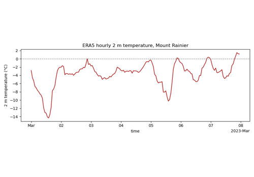
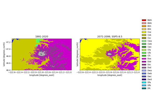
ERA5 reanalysis (ARCO-ERA5 and Earth Engine)

ERA5 reanalysis (ARCO-ERA5 and Earth Engine)

Köppen-Geiger climate classification (Beck et al.)

Köppen-Geiger climate classification (Beck et al.)

previous

Natural Earth map layers: lakes, rivers, glaciers, places

next

ERA5 reanalysis (ARCO-ERA5 and Earth Engine)

Edit on GitHub

© Copyright 2026, Eric Gagliano.

Built with the PyData Sphinx Theme 0.21.0.