easysnowdata.boundaries.glaciers.load#
- easysnowdata.boundaries.glaciers.load(aoi: Any = None, *, version: str = '7.0', product: str = 'glaciers', region: int | list[int] | None = None, source: str | None = None, **kwargs: Any) GeoDataFrame[source]#
RGI glacier outlines intersecting aoi.
- Parameters:
aoi – Any form
easysnowdata.aoi.parse_aoi()accepts.Noneneeds region and returns whole regions.version –
"7.0"(default) or"6.0";7,"v6"and similar work too.product – RGI 7.0 only:
"glaciers"(default) or"complexes".region – First-order region(s) 1-19 to read, instead of looking them up from the AOI (see
regions()).source –
"nsidc"(default, Earthdata Login) or"oggm-mirror"(credential-free, 6.0 only).**kwargs – Passed to
geopandas.read_file.
- Returns:
geopandas.GeoDataFrame–rgi_id,name,area_km2,o1region, then the version’s own attributes, in EPSG:4326.
Examples using easysnowdata.boundaries.glaciers.load#
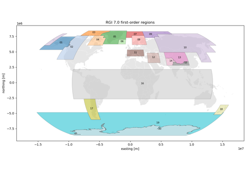
Glacier outlines: Randolph Glacier Inventory 7.0 and 6.0
Glacier outlines: Randolph Glacier Inventory 7.0 and 6.0