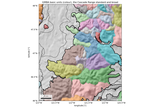
easysnowdata.boundaries.mountains.load#
- easysnowdata.boundaries.mountains.load(aoi: Any = None, *, subset: str = 'basic', extent: str = 'standard', level: int | None = None, name: str | list[str] | None = None, source: str | None = None, **kwargs: Any) GeoDataFrame[source]#
GMBA mountain ranges intersecting aoi (the world when
None).- Parameters:
aoi – Any form
easysnowdata.aoi.parse_aoi()accepts.subset –
"basic"(default, smallest non-overlapping units),"300"(major systems) or"all"(every level, overlapping).extent –
"standard"(default) or"broad".level – Keep only ranges at this hierarchy level (1 = continent … 10); most useful with
subset="all".name – Keep only ranges with this name (
"Cascade Range"), case-insensitive.source – Only
"earthenv"today.**kwargs – Passed to
geopandas.read_file.
- Returns:
geopandas.GeoDataFrame–name(MapName),gmba_id(GMBA_V2_ID),level(Hier_Lvl) andpath(the hierarchy,"North America > …"), then the inventory’s columns (names in eight languages, countries, elevation range,Level_01…Level_10).