Natural Earth vector layers#
natural-earth-vectors · theme boundaries · live
Public-domain cartographic vectors at 1:10m, 1:50m, and 1:110m: lakes, rivers, coastline, land and ocean, glaciated areas, populated places, boundary lines, and more, read by layer name.
import easysnowdata as esd

aoi = (-121.94, 46.72, -121.54, 46.99)   # Mount Rainier
natural_earth_gdf = esd.boundaries.natural_earth.load(aoi)
No account needed
Every route to this product is open. Nothing to set up.
Sources#
source |
provider |
credentials |
resolution |
extent |
temporal |
latency |
notes |
|---|---|---|---|---|---|---|---|
|
vector_http |
none |
— |
global |
static (v5.1.1; a few layers 5.0.0) |
— |
one zipped shapefile per layer and scale, cached on first use |
Where each route points#
natural-earth— Natural Earth livehttps://naciscdn.org/naturalearth/<scale>/<category>/ne_<scale>_<layer>.zip
Provenance#
Licence · Public domain
Cite the data as
Natural Earth. Free vector and raster map data @ naturalearthdata.com.
Documentation
Gallery examples#
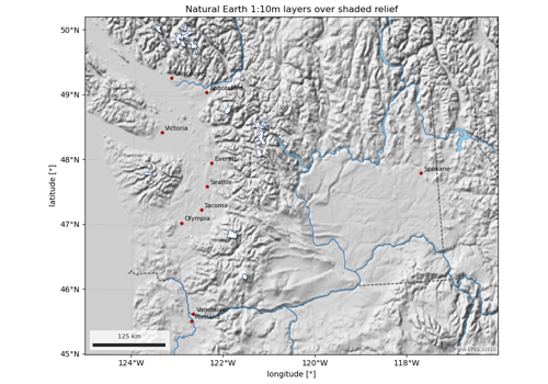
Natural Earth map layers: lakes, rivers, glaciers, places