USGS 3DEP seamless DEM (10 m / 30 m, United States)#
3dep · theme terrain · no data
The USGS 3D Elevation Program seamless bare-earth DEM at 1/3 arc-second (~10 m) and 1 arc-second (~30 m): lidar where it has been flown, legacy sources elsewhere, so the acquisition date varies by tile. Conterminous US, Alaska (mostly coarser), Hawaii and territories; NAD83 horizontal, NAVD88 vertical. A terrain model, not a surface model: forest canopy is removed, which the global DEMs above do not do.
import easysnowdata as esd

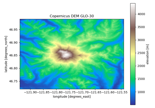
aoi = (-121.94, 46.72, -121.54, 46.99)   # Mount Rainier
data = esd.terrain.dem.load(aoi)
No account needed for the default route
source="planetary-computer" is open. source="gee" needs earthengine — see the credentials page.
Sources#
2 routes serve this product; the first is the default and source= picks another. The return contract is the same either way.
source |
provider |
credentials |
resolution |
extent |
temporal |
latency |
notes |
|---|---|---|---|---|---|---|---|
|
stac |
none |
10 m |
United States |
static (tile dates 1925-2020; updated as lidar arrives) |
— |
signed hrefs, anonymous; one collection holding both resolutions, selected by gsd |
|
gee |
earthengine |
10 m |
United States |
static (tile dates 1925-2020) |
— |
the 1/3 arc-second layer as a tiled ImageCollection, mosaicked here; 10 m only |
Where each route points#
planetary-computer— Planetary Computer no data3dep-seamlessgee— Earth Engine no dataUSGS/3DEP/10m_collection
Variables#
variable |
units |
dtype |
nodata |
categorical |
|---|---|---|---|---|
|
m |
float32 |
-999999 |
no |
Provenance#
Licence · Public domain (US government data)
Cite the data as
U.S. Geological Survey (2019). 3D Elevation Program 1/3 arc-second and 1 arc-second Digital Elevation Models. https://www.usgs.gov/3d-elevation-program
Documentation
Loader · easysnowdata.terrain.dem.load
Gallery examples#