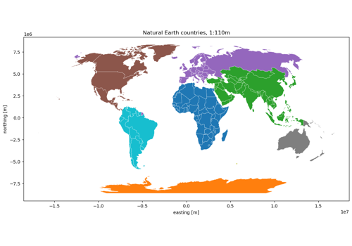
Country boundaries#
countries · theme boundaries · live
Country polygons worldwide: Natural Earth at 1:10m, 1:50m or 1:110m, or geoBoundaries ADM0 country by country.
import easysnowdata as esd

aoi = (-121.94, 46.72, -121.54, 46.99)   # Mount Rainier
countries_gdf = esd.boundaries.admin.countries(aoi)
No account needed
Every route to this product is open. Nothing to set up.
Sources#
2 routes serve this product; the first is the default and source= picks another. The return contract is the same either way.
source |
provider |
credentials |
resolution |
extent |
temporal |
latency |
notes |
|---|---|---|---|---|---|---|---|
|
vector_http |
none |
— |
global |
static (v5.1.1; a few layers 5.0.0) |
— |
zipped shapefile, cached on first use; 1:10m, 1:50m, and 1:110m |
|
vector_http |
none |
— |
global |
continuously updated |
— |
ADM0; one country per request through the gbOpen API, GeoJSON cached per release |
Where each route points#
natural-earth— Natural Earth livehttps://naciscdn.org/naturalearth/<scale>/cultural/ne_<scale>_admin_0_countries.zipgeoboundaries— geoBoundaries (gbOpen) livehttps://www.geoboundaries.org/api/current/gbOpen/<ISO3>/ADM<level>/
Variables#
variable |
units |
dtype |
nodata |
categorical |
|---|---|---|---|---|
|
— |
— |
— |
no |
|
— |
— |
— |
no |
|
— |
— |
— |
no |
Provenance#
Licence · Public domain (Natural Earth); CC BY 4.0 (geoBoundaries gbOpen)
Cite the data as
Natural Earth. Free vector and raster map data @ naturalearthdata.com.
Documentation
Gallery examples#